Columbia Point Master Plan
Boston, MA
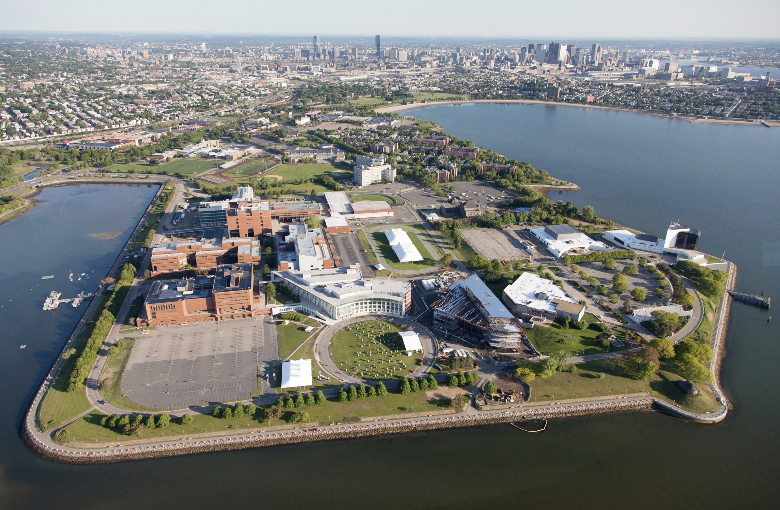
This APA-award winning master plan is a vision for the redevelopment of the 400-acre Columbia Point peninsula on the Boston Harbor - one of the last remaining underdeveloped neighborhoods in Boston.
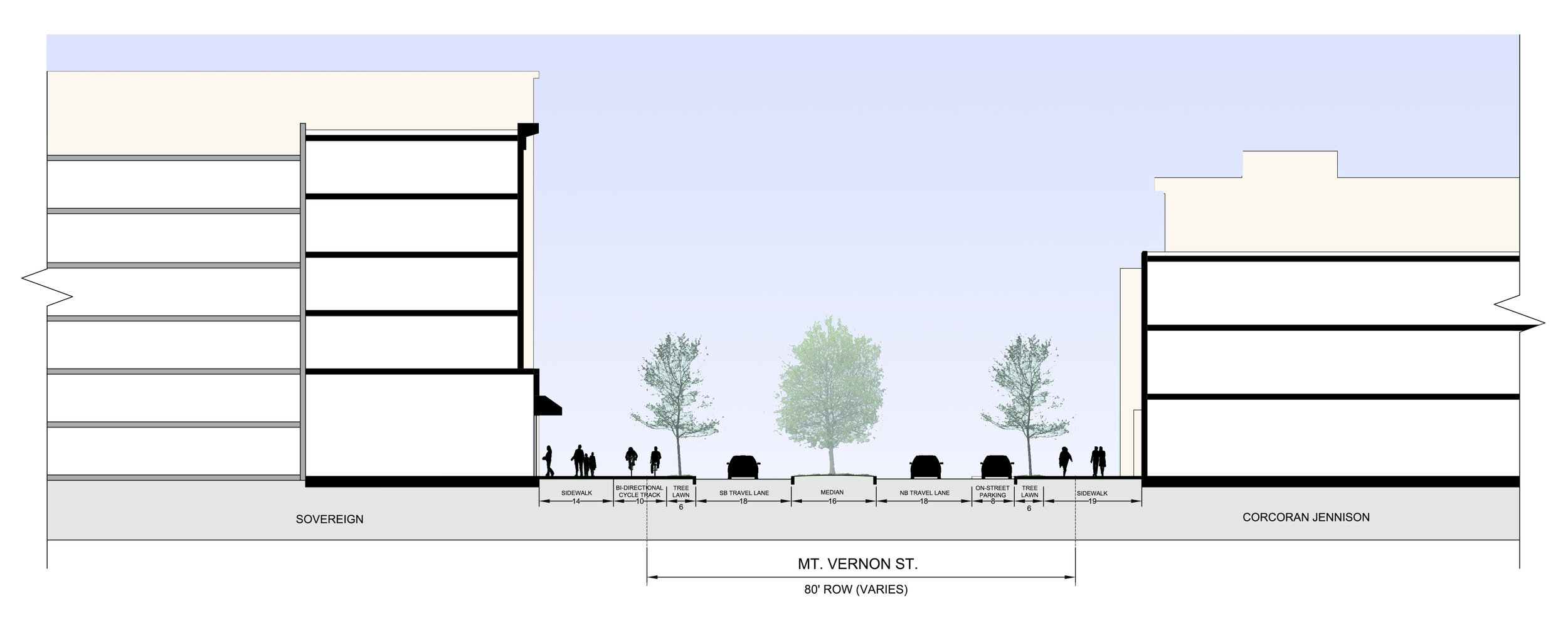
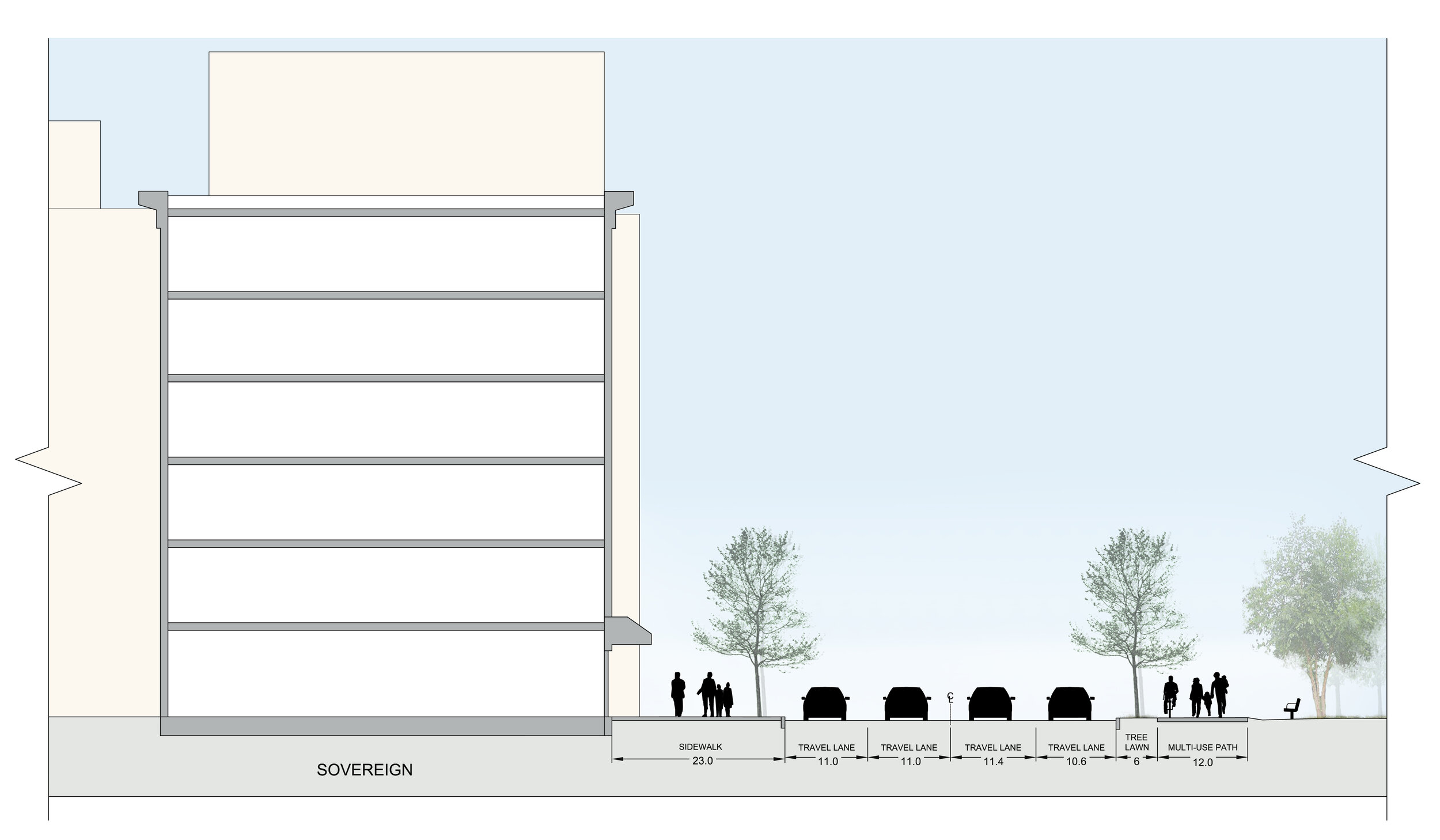
The 400-acre Columbia Point peninsula on the Boston Harbor is one of the last remaining underdeveloped neighborhoods in Boston. It is currently a predominately auto-oriented neighborhood and lacks adequate pedestrian and vehicular connections. This Master Plan establishes a future vision for a new and sustainable neighborhood built on a rational system of streets, blocks, and buildings that serves existing and proposed land uses, with a focus on creating a series of transit-oriented, mixed-use districts within a quarter-mile of the existing MBTA Red Line subway and commuter rail station. The Columbia Point Master Plan won the American Planning Association Comprehensive Plan Award in 2011.
Role
Local Form Studio’s Christopher Riale conducted a detailed land use analysis, prepared the 6 million sq. ft. development program, site plans, and 3D modeling, and assisted in the creation of urban design principles that provided the framework for the Master Plan.
* Work completed by Christopher Riale while employed with Crosby, Schlessinger & Smallridge, LLC.
Client
Boston Redevelopment Authority (BRA)
Scale
400 acres
5.7 million s.q. ft. of mixed use development,
including residential, hotel, office, retail, and recreational open space
Key Services
Neighborhood Planning
Urban Design
Year: 2009 - 2010


